Furacão Matthew

Stu Ostro ‏@StuOstro 15 minHá 15 minutos
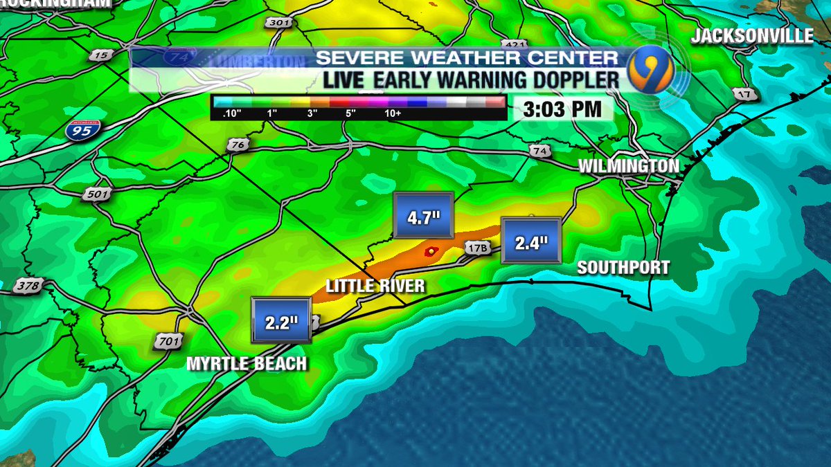
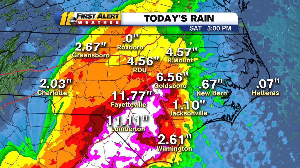
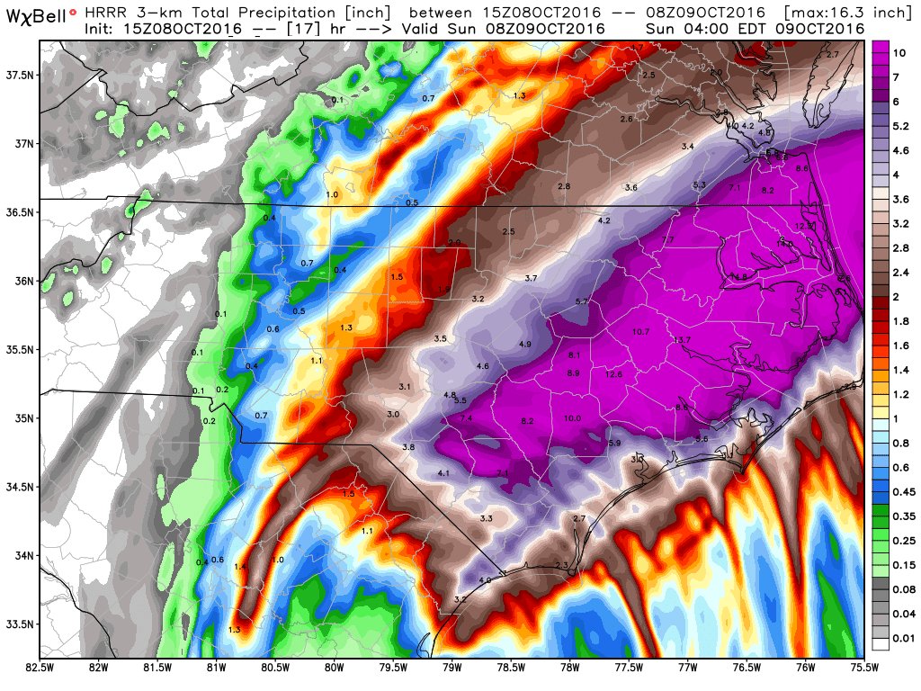
#HurricaneMatthew inland #flood situation escalating as torrential downpours fall on already-saturated soil, w/much more rain yet to come

CuQo8hnWEAE38Cb.jpg

11 retweets3 curtiram
 
Já há 6 mortos na Florida. Ainda não tenho link para postar...
2 mortos em clarkton, NC. Um carro apanhado pelas águas... já são 8 mortos no total.

Edit1: Já são 3 mortos em NC. 9 mortos no total.

Edit2: The Latest on Hurricane Matthew (all times local):

2:50 p.m. (Eastern TIme)

Five new deaths have been reported in the Southeast in the wake of Hurricane Matthew. That brings the death toll in the United States from the storm to nine.

Gov. Pat McCrory said Saturday that the hurricane killed three people in North Carolina.

McCrory said at a press conference that "this is a very, very serious and deadly storm."

In Georgia, Bulloch County deputy coroner Richard Pylant said two people died there. One of the casualties was a man in a wheelchair who died when two trees fell on his home.

Officials have previously reported four deaths in Florida.
 
Última edição:
  • Gosto
Reactions: Wessel1985
142. Dr. Jeff Masters , Director of Meteorology (Admin)
08:04 PM GMT em 08 de Outubro de 2016
0
+
Modified the blog post to add the new storm tide record for Wilmington:


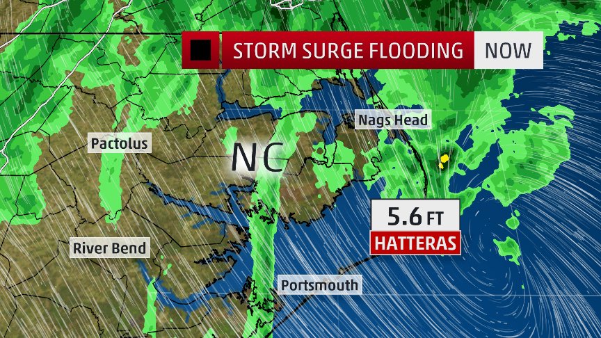
Three tide gauges with long-term historical records along this stretch of coast set all-time records on Friday or Saturday for their highest water level (also called the storm tide, or the water level measured relative to high tide, MHHW):

Fort Pulaski, Georgia: 5.06’
Previous record: 3.40’ during the October 15, 1947 hurricane (records since 1935.)

Wilmington, NC: 3.49’ (and still rising as of 4 pm EDT Saturday.) Previous record 3.47’, during Hurricane Hazel on October 15, 1954 (records since 1935.)

Mayport, FL: 3.28’
Previous record: 2.47’, during Hurricane Jeanne on September 27, 2004 (records since 1928.)

Jeff Masters
https://www.wunderground.com/blog/JeffMasters/comment.html?entrynum=3473#commenttop
 
Philip Klotzbach ‏@philklotzbach 1h1 hour ago Fort Collins, CO
A brief prelim recap of some of Hurricane #Matthew's meteorological records & other notable facts:

Hurricane Matthew Records/Notable Facts Recap (through October 8)
Intensity
- 80 mph intensification in 24 hours – the 3rd strongest rapid intensification in the
Atlantic on record (trailing Wilma-2005 & Felix-2007).
- 31st Atlantic Category 5 hurricane on record and the 1st since Hurricane Felix
(2007)
- Lowest latitude Atlantic Category 5 hurricane on record
- 6
th lowest MSLP for any Atlantic October on record at 934 mb (trailing Joan,
Opal, Mitch, Wilma & Joaquin). Consistent MLSP records date back to 1979.

Longevity
- Longest-lived Category 4-5 hurricane in the eastern Caribbean (<=20°N, 90-
60°W) on record.
- Generated the most Accumulated Cyclone Energy on record for any hurricane in
the eastern Caribbean
- Maintained Category 4-5 hurricane strength for 102 hours in October – the
longest that a hurricane has maintained Category 4-5 strength on record during
October in the Atlantic
- Maintained major hurricane strength for 7.25 days – the longest-lived major
hurricane forming after September 25 on record and longest lasting at any time of
year since Ivan (2004). Tied with Fabian (2003) for 5th longest major hurricane in
satellite era (since 1966)
- Currently ranked 8th for Accumulated Cyclone Energy by an Atlantic hurricane in
the satellite era

Landfall
- 1st Category 4 hurricane to make landfall in Haiti since Cleo (1964)
- 1st Category 4 hurricane to make landfall in Cuba since Ike (2008)
- 1st time on record that a major hurricane has made landfall in Haiti, Cuba and
the Bahamas
- 2nd time that a Category 4 hurricane has made landfall in the Bahamas since
1866 (Joaquin-2015 was the other)
- 1
st hurricane to make landfall in South Carolina since Gaston (2004)
- 1
st hurricane to make landfall north of Georgia in October since Hazel (1954)
Note: While Atlantic hurricane records go back to 1851, there are likely
underestimates in storm intensity prior to the satellite era (since 1966) and
especially prior to aircraft reconnaissance (since 1944)
 
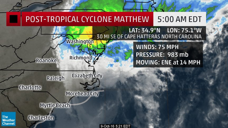
POST-TROPICAL CYCLONE MATTHEW DISCUSSION NUMBER 46
NWS NATIONAL HURRICANE CENTER MIAMI FL AL142016
1100 AM EDT SUN OCT 09 2016

Satellite data and surface observations indicate that a cold
front has wrapped around the southwestern portion of Matthew's
circulation and the post-tropical cyclone is now analyzed as an
extratropical low. Despite the change in the cyclone's structure
over the past 24 hours, Matthew continues to produce an area of very
strong winds to the southwest and west of the center. Sustained
winds of 55 to 60 kt with gusts above hurricane force were reported
at several coastal marine observing stations near the Outer Banks of
North Carolina this morning, and a recent dropsonde from the Global
Hawk unmanned aircraft reported surface winds of 58 kt. Based on
these data, the initial intensity remains 65 kt. The global models
indicate that the post-tropical cyclone will gradually weaken during
the next 24 to 36 hours, and be absorbed by a frontal boundary in
about 48 hours.

Matthew is moving eastward at about 13 kt. The low should continue
moving eastward within the mid-latitude westerly flow during the
next day or so. The NHC forecast track is close to a blend of the
ECMWF, GFS, and UKMET models, and is similar to the previous
advisory.

Strong winds in the Tidewater Region of Virginia are being handled
by non-tropical wind warnings.