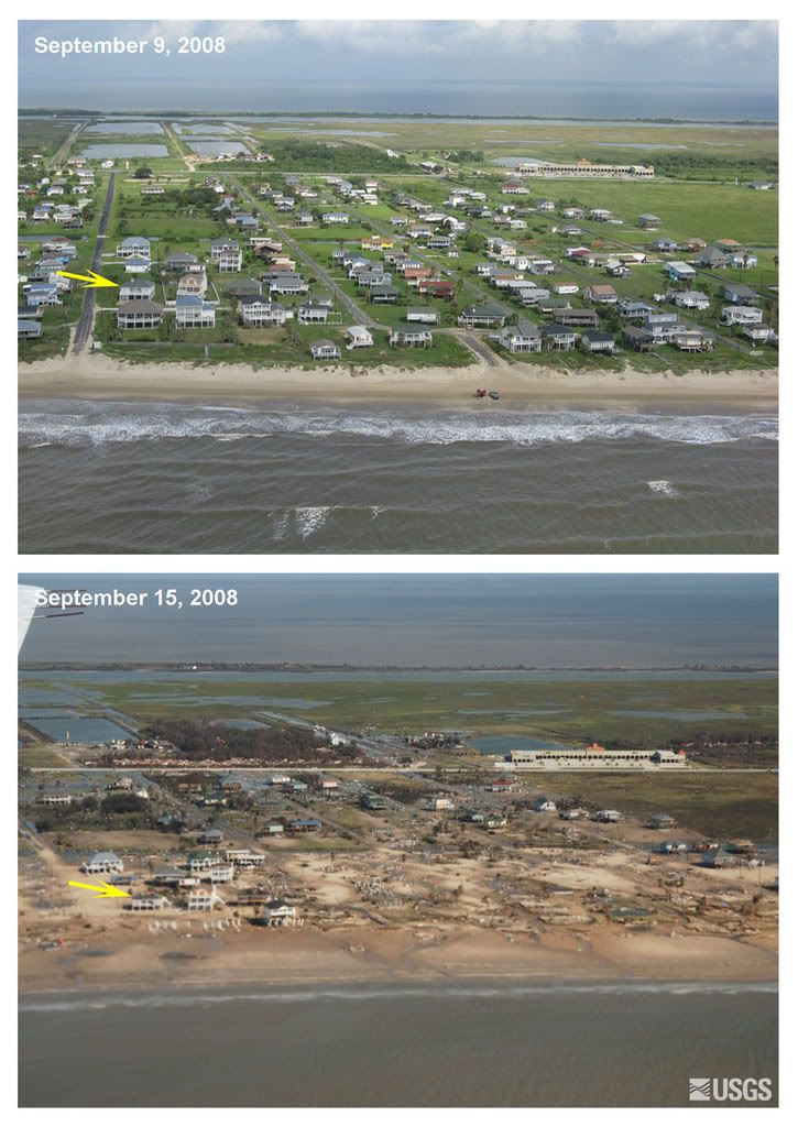
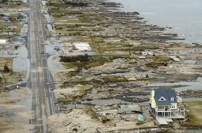
Ex-Hurricane Ike makes landfall in Northern Europe
Meteosat-9 Airmass RGB 17.09 12:00 UTC
After ravaging the Caribbean and the United States, there still was not much to like about Hurricane Ike as it moved to Canada and then back across the Atlantic in a weakened state, as observed by EUMETSAT’s Meteosat-9 satellite. Unlike most tropical hurricanes, which are fuelled by a warm ocean and normally die a few days after landfall, much of Ike’s humidity and momentum was mixed up into a frontal system after it hit land in Texas and this system then traversed the North American continent in a north-easterly direction. Before the remains of Ike died in the North Atlantic, the hurricane brought gales to and dumped rain on Greenland and Iceland, the Danish Meteorological Institute reported.
Low pressure delivered strong winds when the air masses received added momentum down the mountain slopes of Greenland, where some settlements reported gales from the north-west. The interaction between swells and wind waves from Ike produced nine-metre-high waves in the Denmark Strait between Greenland and Iceland. South-eastern Greenland also experienced the remnants of Ike with gale force winds and local “Piteraq”, an autumn wind blowing down from the ice shield.
The Iceland Meteorological Office reported that Hurricane Ike contributed moisture and momentum to a low pressure system just west of Iceland on Tuesday evening and into Wednesday morning, 16-17 September, with unusually high, albeit not record-breaking, amounts of precipitation. Some 200 millimetres of precipitation were measured close to Reykjavik in 24 hours, reaching as much as 18-20 millimetres an hour at its most intense. Gusts of up to 40 metres per second were measured. This is not so unusual for this time of year; the difference is that the weather was bad everywhere on Iceland. Normally it would be relatively quiet in the north-east, when storms are raging in the south-west, and vice versa. Remains of former tropical hurricanes reach Iceland only every second to fourth year.
Extratropical depression - So Ike continued as an extratropical (outside the tropics) low pressure system. During the shift to extratropical conditions, cold and warm air masses are mixed into the rotation. Thus, the energy no longer comes from warm sea water, but from the difference in temperature between the air masses. When air masses with different characteristics meet, the system will form fronts: a warm front and a cold front.
After Iceland, Ike will finally die away, almost three weeks after the low pressure system was formed near Cape Verde off the west coast of Africa. It happens only once or twice a year that the remains of a hurricane manage to travel all the way to the northern latitudes. Normally the weather systems will fizzle out while passing the high pressure belt around 30 degrees north of the Equator.
Eumetsat


