MARIA VENTOS SUSTENTADOS EM 280 KM/H E PRESSÃO 909 MBAR.
OITAVO FURACÃO MAIS INTENSO DO ATLÂNTICO.


OITAVO FURACÃO MAIS INTENSO DO ATLÂNTICO.


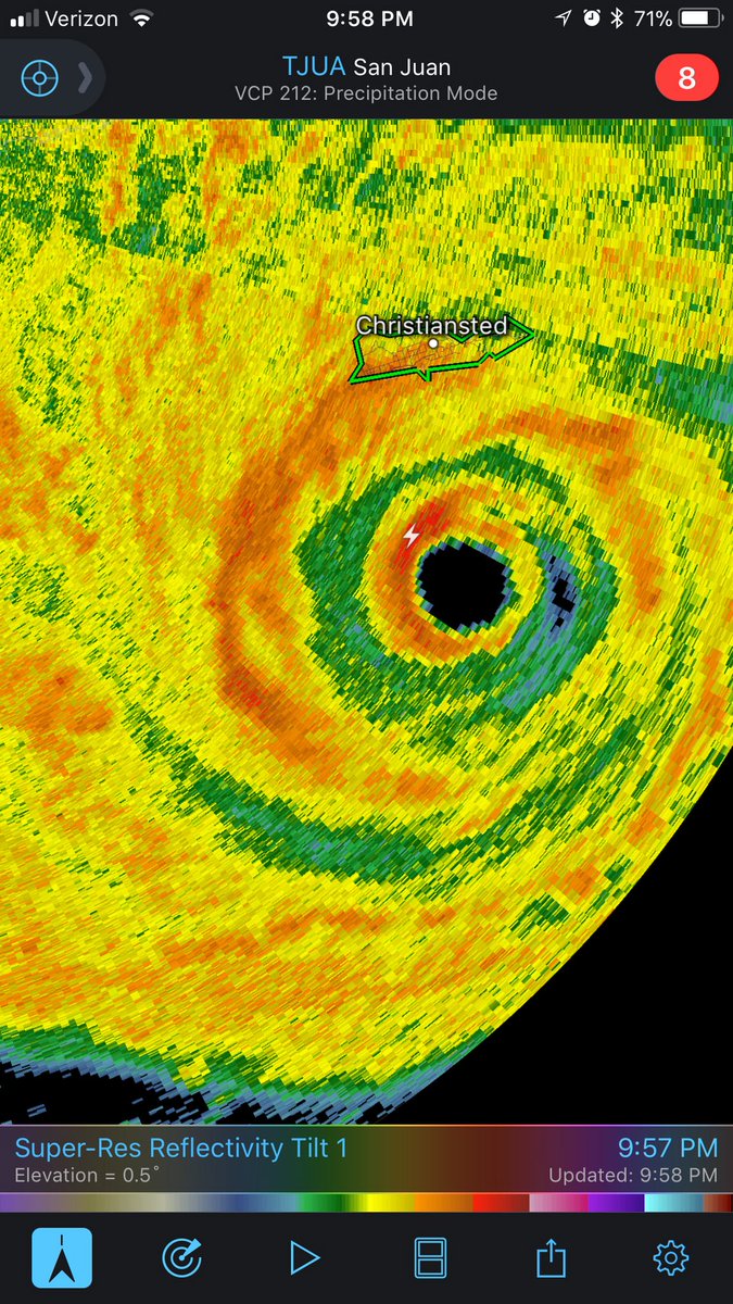
Since the previous advisory, WSR-88D radar data from San Juan Puerto Rico has shown the development of concentric eyewalls and a double-wind maximum. This has led to an increase in the size of the 50- and 64-kt wind radii.
Since the outer eyewall has become better defined and the winds are increasing within the outer eyewall, it is likely that Maria's intensification will finally cease.
FORECAST POSITIONS AND MAX WINDS
INIT 20/0300Z 17.3N 64.7W 150 KT 175 MPH
12H 20/1200Z 18.0N 65.8W 145 KT 165 MPH
24H 21/0000Z 18.9N 67.3W 125 KT 145 MPH


