Estofex.....if you consider yourself a stormchaser..this is probably one of th best days ever in Iberia!
We were not doing bad here either. WInermonths are not really known for supercells here. Yesterday, late in the afternoon I wnet outside in my city and noted a really huge icecap from a culumbonimbus cloud just a fraction north of us. I could not get a good look at first, but when I crossed the centralmarket place (and open space in the city where I live) I noted a massive, massive storm. Really like a atomic bomb had exploded and then some....And I also noted the storm was twisted. The icecap moved westward, the clouds below it (which also were at least 8 km away) moved more to the north.
Okey..I had to do some grocesries and told myself "don't exaggerate! You are probably seeing more than there really is." 10 minutes later I wnet back home and had to go into the countryside. took my photogear with me. The sun already had set...Second storm was visible with the same, structure. It had really all the signs of a supercell but I was underwhelemd...because it was february...
Long story short: I heard that these cells produced wallclouds and one went over me with 1 cm hail...
So my lesson: pay attention and believe what you see. SOmehow, I consistently tend to deny this for some reasons and carry on with what I am doing....Have fun!
"DISCUSSION
...Portugal and Spain...
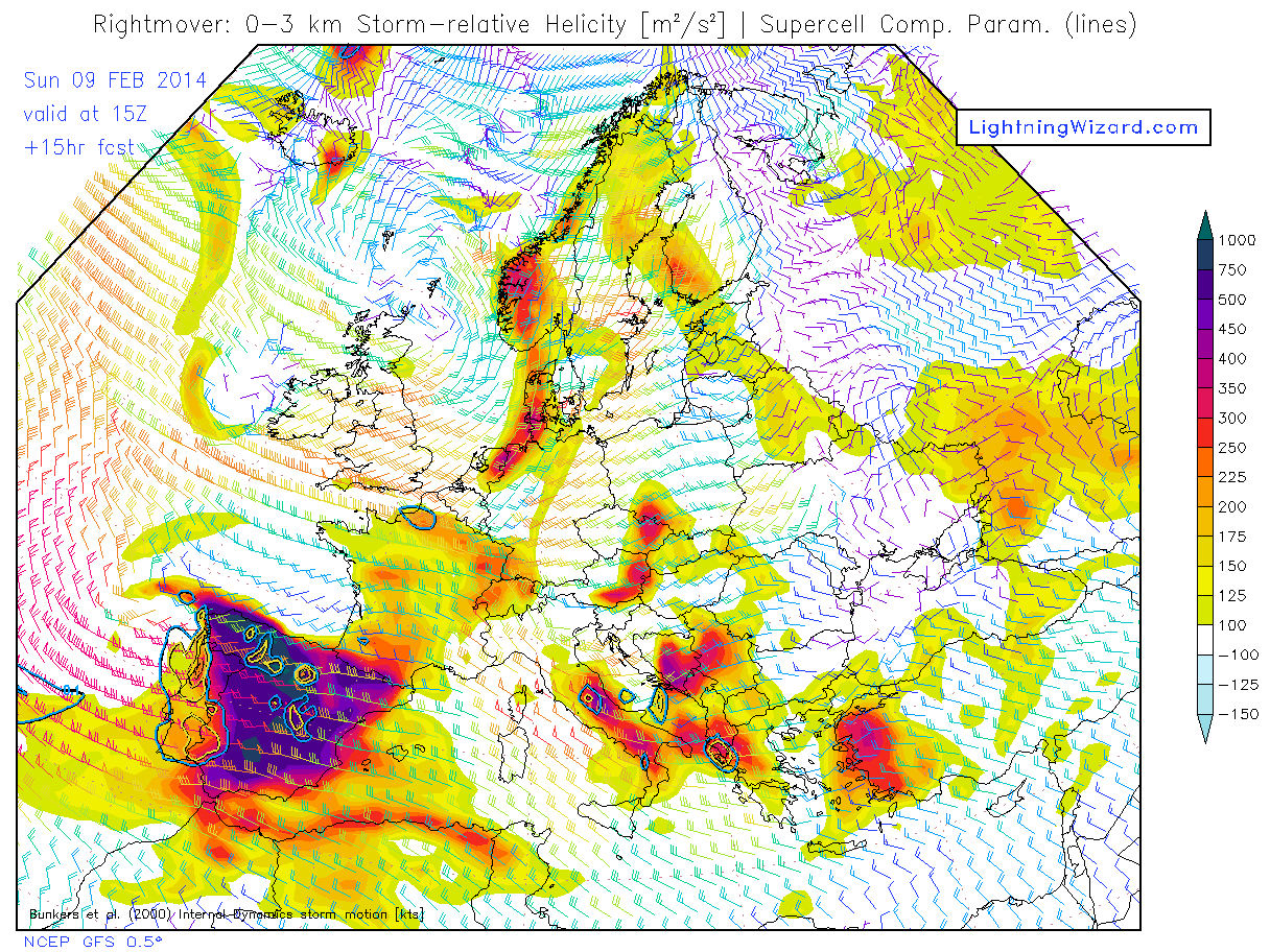
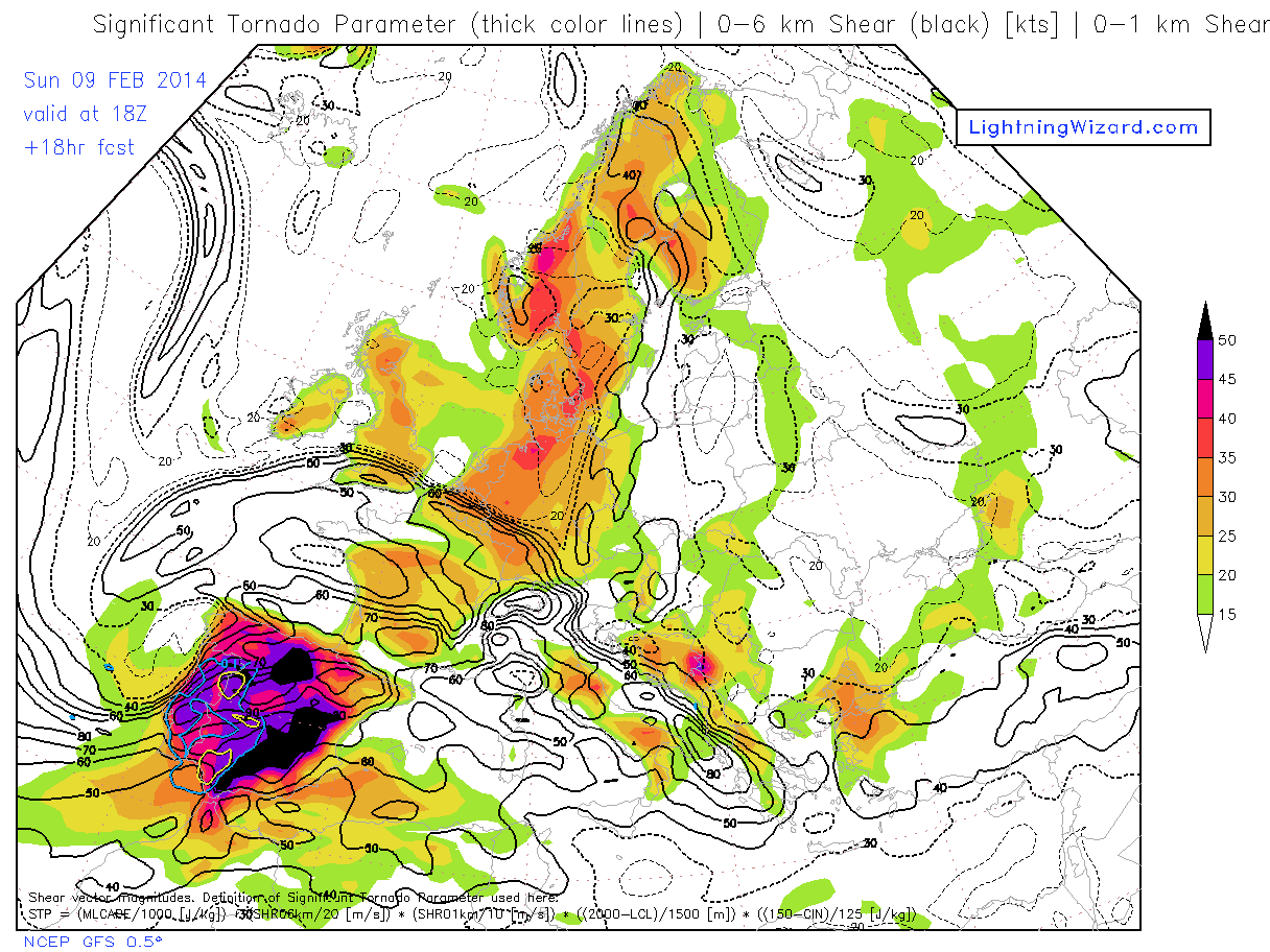
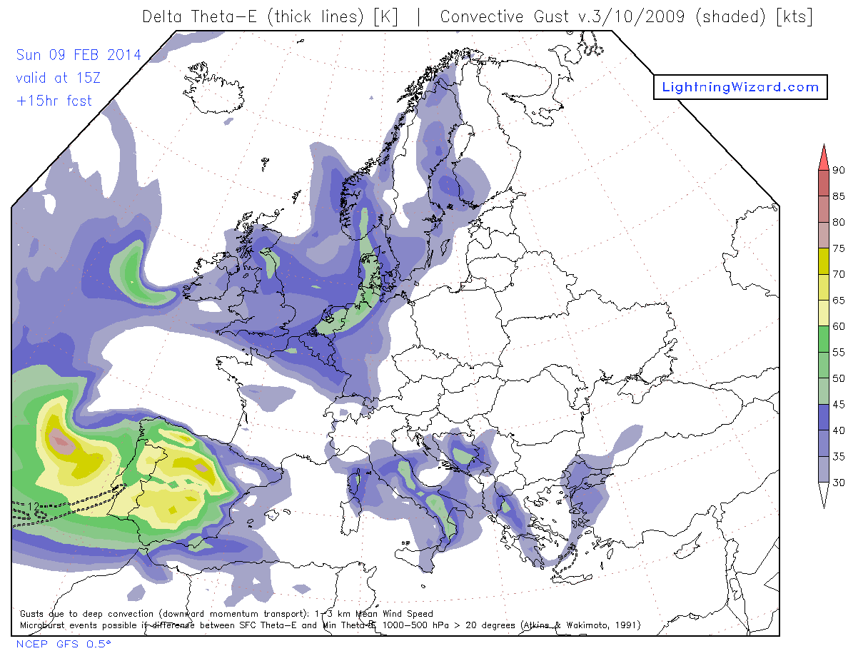
Models agree on a wide overlap of a few hundred J/kg CAPE and impressive vertical wind shear in all layers (e.g. 35 m/s 0-6 km shear and >17 m/s 0-1 km shear, >400 m²/s² 0-1 km and 0-3 km SREH (GFS model) with also very low LCL heights. This is highly supportive of mesocyclone and tornado development in thunderstorms, as well as bow echoes. Almost 1000 m²/s² 0-3 km SREH is forecast inside the warm sector where CAPE is not present. Instead, CAPE should develop in the region behind the mid level cold front which passes earlier than at low levels, creating a zone of warm humid low levels overspread by low theta-e mid levels and any lift in this potential instability region should result in development of conditional instability In this region the actual SREH for rightmoving cells is weak and for left-moving cells with respect to the mean wind is strong. The leftmoving motion vector would still have a southwesterly orientation. Mean winds aloft (1-3 km) reach over 30 m/s and may be transported to ground by deep convection. This is helped by the likely linear organization at the cold front, forced also by a deep potential vorticity intrusion.
The episode should start during the afternoon in Portugal with probably some discrete supercells with a preference for leftmovers and take on more linear shapes over the southern half of Spain around 21Z when PV edge, surface and mid level cold front positions become collocated. Significant tornadoes may occur but severe convectively enhanced wind gusts should be more widely observed.
The surface based CAPE in GFS seems to be reducing towards the east, turning into elevated CAPE. This may be due to the higher Saharan T850 advecting into southern Spain. It might stabilize the near-ground levels and reduce gust and tornado threat while maintaining the excessive precipitation threat which also is partly stratiform in nature, by the moist air advecting and lifting at high rates over local terrain."


 ehehe..