tonítruo
Nimbostratus
A treinar os membros do fórum para serem mais completos nas publicações.São avisos de quê?


A treinar os membros do fórum para serem mais completos nas publicações.São avisos de quê?
O grande teste às bombas do túnel. Aqui, estou a salvo é a descer.
O modelo da AEMET coloca entre 40 a 60 mm em 6 horas entre as 7h e as 13h, mas a tempestade do século vai ser entre Sevilha e Córdoba com mais de 100 mm na madrugada de Sábado, aquele vermelho naquela zona vai ser obra.E com cerca de 70 mm em 6h, tanto no ecm como no ukmo...
Já o gfs não mostra nada disso...
Uma coisa é certa, algum modelo vai falhar estrondosamente amanhã...
Esta pode ser a tempestade do século!
A Andaduzia é praticamente do tamanho de Portugal.Andaluzia é caso de estudo!!
Já disse isto paletes de vezes, tem um íman gigante por aquelas bandas!
Eu cá não recebi nada, sou um info excluído da sociedade.Aqui pelo Sul, já estamos a receber SMS da ProtCivil, para chuva forte e persistente nas próximas 48 horas. Vento Forte. Risco de Inundações.
A Póvoa de Santa Iria também...Eu cá não recebi nada, sou um info excluído da sociedade.


 www.publico.pt
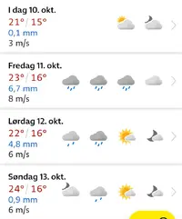
Ver anexo 14968
InB4 típico update do IPMA à última da hora a meter os amarelos a laranja e o resto do país a amarelo.
A minha publicação para o efeito pretendido estava completaA treinar os membros do fórum para serem mais completos nas publicações.
Se eu tivesse feito o post no tópico dos avisos já te daria razão, no entantoNunca percebi porque é que a precipitação é encaminhada sempre mais facilmente para a Andaluzia do que para o Alentejo e Algarve? Há alguma explicação para isto? Orografia da costa ?À espera da previsão mais actual (12z) fica esta mista (00z+06z):
Ver anexo 14982
E a comparação dos acumulados até Sábado à noite pelo UKMO 00z e 06z
Ver anexo 14983
Ver anexo 14984
Houve uma transferência do Algarve para o Alentejo e bacia do Tejo, e também, classicamente, para a Andaluzia, mas mesmo assim mantém-se bons acumulados pelo Barlavento e litoral sotaventino.
O WRF 06z distribui bem por todo o Algarve, numa média de 100mm.
Ver anexo 14985
O ICON 06z é frustrante para o Algarve, quase tudo para a Anadluzia:
Ver anexo 14986
O GFS 06z também põe a precipitação a fugir para a Andaluzia:
Ver anexo 14987
O ECMWF 06z (op.) mete para os dois lados da fronteira, mas também mais para os vizinhos:
Ver anexo 14988
A média do ensemble do ECMWF 00z não difere muito da operacional 06z:Ver anexo 14989
Deve ter a ver com isso. Algum forçamento adicional por causa daquela extensão mais a sul criar ali uma “parede”, digo eu. Mas percebo pouco dissoOrografia da costa ?